Montenegro – Bay of Kotor
Montenegro is a country with an area of 13,812 square kilometers, with a total population of 621,000. Podgorica is the capital and largest city.
From the late 14th century to the late 18th century, large parts of southern Montenegro were ruled by the Venetian Republic and incorporated into Venetian Albania. Montenegro’s independence was recognized at the Congress of Berlin in 1878. In 1910, the country became a kingdom. After World War I, the kingdom became part of Yugoslavia. Following the breakup of Yugoslavia, Montenegro declared its independence in June 2006.
Montenegro features high peaks along its borders with Serbia, Kosovo, and Albania, a segment of the Karst of the western Balkan Peninsula, to a narrow coastal plain that is only 1.5 to 6 kilometers wide. The plain stops abruptly in the north, where Mount Lovćen and Mount Orjen (1,894 m) plunge into the inlet of the Bay of Kotor. The mountains of Montenegro include some of the most rugged terrains in Europe. The peak of Bobotov Kuk in the Durmitor mountains reaches a height of 2,522 m
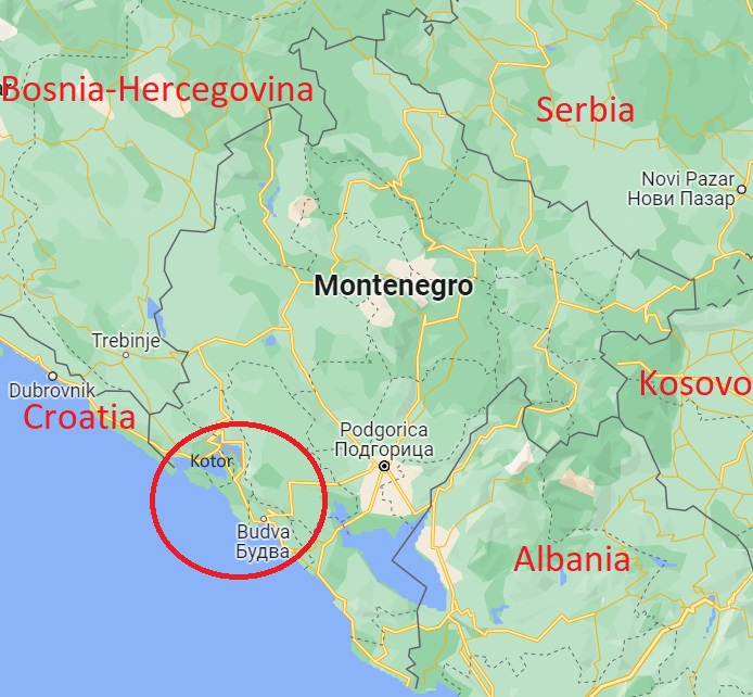
I visited Montenegro in March-April 2023, mostly in the Kotor Bay region (See map), on a Croatia, Bosnia-Hercegovina and Montenegro tour.
(See the full movie here).
Perast town and Kotor Islets, 2. April 2023
There are two small islands in the Kotor Bay, not far from the town of Perast.
Our Lady of the Rocks (Gospa od Skrpjela) is an artificial island created by bulwark of rocks and by sinking old and seized ships loaded with rocks. The Roman Catholic Church of Our Lady of the Rocks is the largest building on the islet; it has a museum attached.
Sveti Dorde Island (“Island of Saint George”) is a natural island the Saint George Benedictine monastery, constructed in the 12th century. There is also an old graveyard for the old nobility from Perast and further from the whole Bay of Kotor.
I visited the church on a boat tour from Perast to Kotor.
Kotor old town, 2. April 2023
The old Mediterranean port of Kotor is located in one of the most indented parts of the Adriatic Sea part in the Bay of Kotor. The city has a population of about 13,500 and is the administrative center of Kotor Municipality. Kotor is surrounded by fortifications built during the Venetian period. Some have called it the southernmost fjord in Europe, but it is a submerged river canyon. Together with the nearly overhanging limestone cliffs of Orjen and Lovćen, Kotor and its surrounding area form an impressive landscape. The old town of Kotor is a World Heritage Site.
I walked the streets of the old town and climbed to the chapel halfway up to the Castle of San Giovanni on top of the cliff above the town.
Budva – old town and harbor, 2. April 2023
Budva is a Montenegrin town on the Adriatic Sea. It has about 19,200 inhabitants, and it is the center of Municipality. The coastal area around Budva, called the Riviera, is the center of Montenegrin tourism, known for its well-preserved medieval walled city, sandy beaches and diverse nightlife. Budva is 2,500 years old, which makes it one of the oldest settlements on the Adriatic coast. The Old Town is situated on the southern end of a rocky peninsula and is encircled with defensive stone walls. The fortifications of are typical of the Medieval walled cities of the Adriatic, complete with towers, embrasures, fortified city gates and a citadel. While the site was permanently settled since Roman era, most of existing city walls and buildings were erected during the Venetian rule.
We stayed overnight in Montenegrinia Hotel in the next bay.
Herceg Novi, 8. April 2023
Herceg Novi has had a turbulent past, despite being one of the youngest settlements on the Adriatic. A history of varied occupations has created a blend of diverse and picturesque architectural style in the city.
While we stayed for a week in Carine Park Hotel in Bijela, in the Bay of Kotor, we took the local bus (Blue Line) to the regional capital Herceg Novi. We walked down through the old town and followed the seaside promenade below the town to the neighboring/connected town of Igalo. In Herceg Novi main square, with view to the old castle, we enjoyed one of the outdoor restaurants, and had a coffee at a restaurant terrace with view of the Adriatic sea.
Bijela area, 3-11. April 2023
During our week in Bijela I took short walks from our Carine Park Hotel to the town center, and along the coast – one day to the Portonovi marina, and one day to take the ferry across Kotor Bay.
This video includes our return trip to Dubrovnik for an over-night stay before flying home to Norway.